3D Visualization and Mapping

A USAF-trained intelligence systems & operations analyst. Experienced visual designer providing geo-spatial mapping, 3D visualizations, and media solutions. Reach out to get started on a project.
Recurring Media, 3D Visuals, and Maps
per month
per week
Custom Schedule
Packaging your models for use in 3D platforms
Site Visits, Analysis, and Updates
Priority Support and Consultation
1 Consult Per Month
3 Consults Per Month
Unlimited
Spatial Visualization Solutions
Take your business operations, land project, or event planning to the next level with designer solutions and geo-spatial maps for asset management, job sites, visual presentations, event planning, or marketing efforts.
3D Capture, Visualization, Media
Convert your land, assets, or interior spaces to 3D content, capturing valuable insights to include in portfolios, websites, or project presentations.
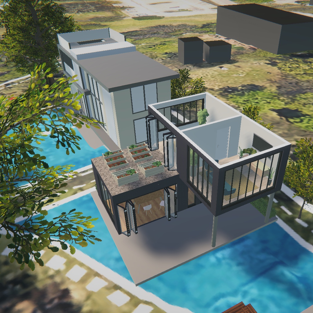
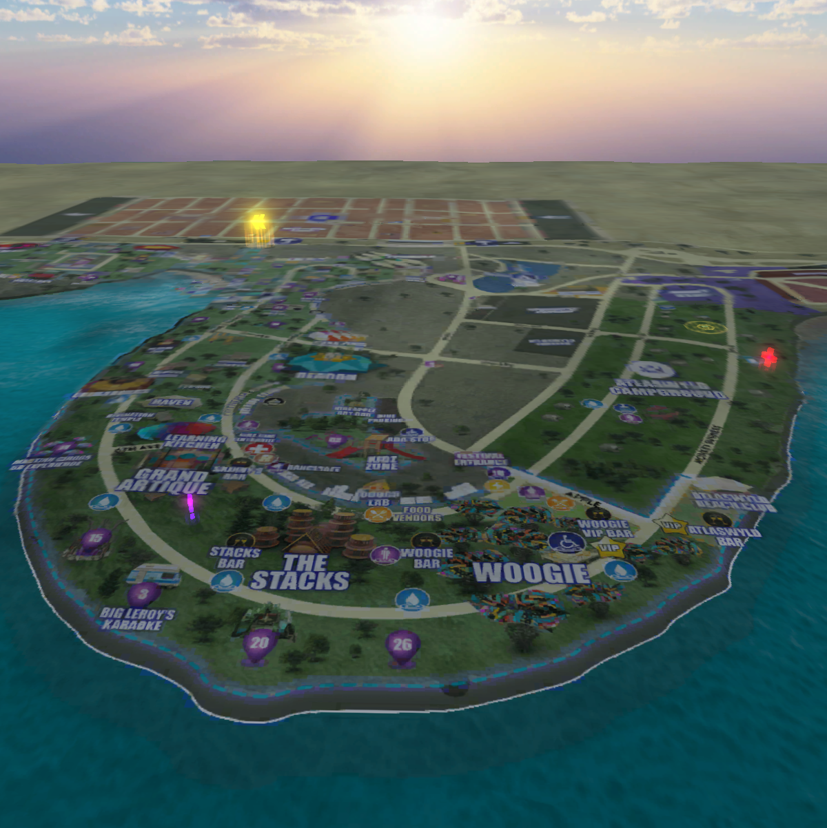
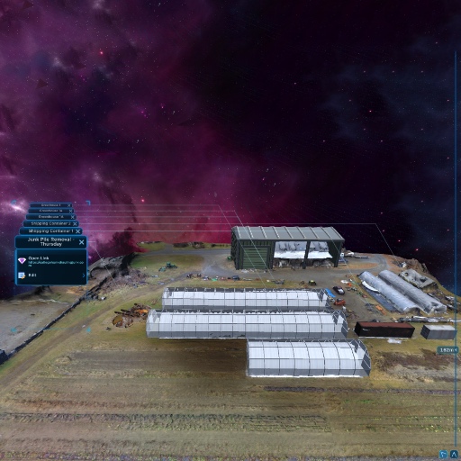
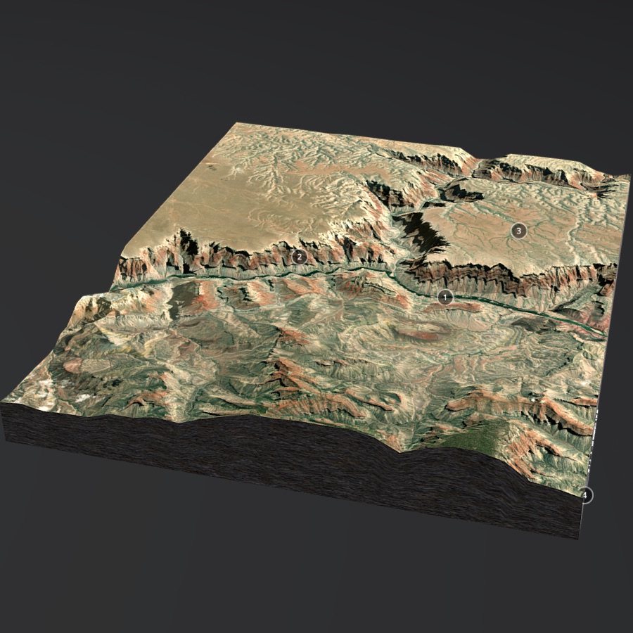
3D Map of Nearly Any Location Worldwide
On-site and Remote Digitization
Flexible file formats
3D Embed, Video Banners, Fly Throughs
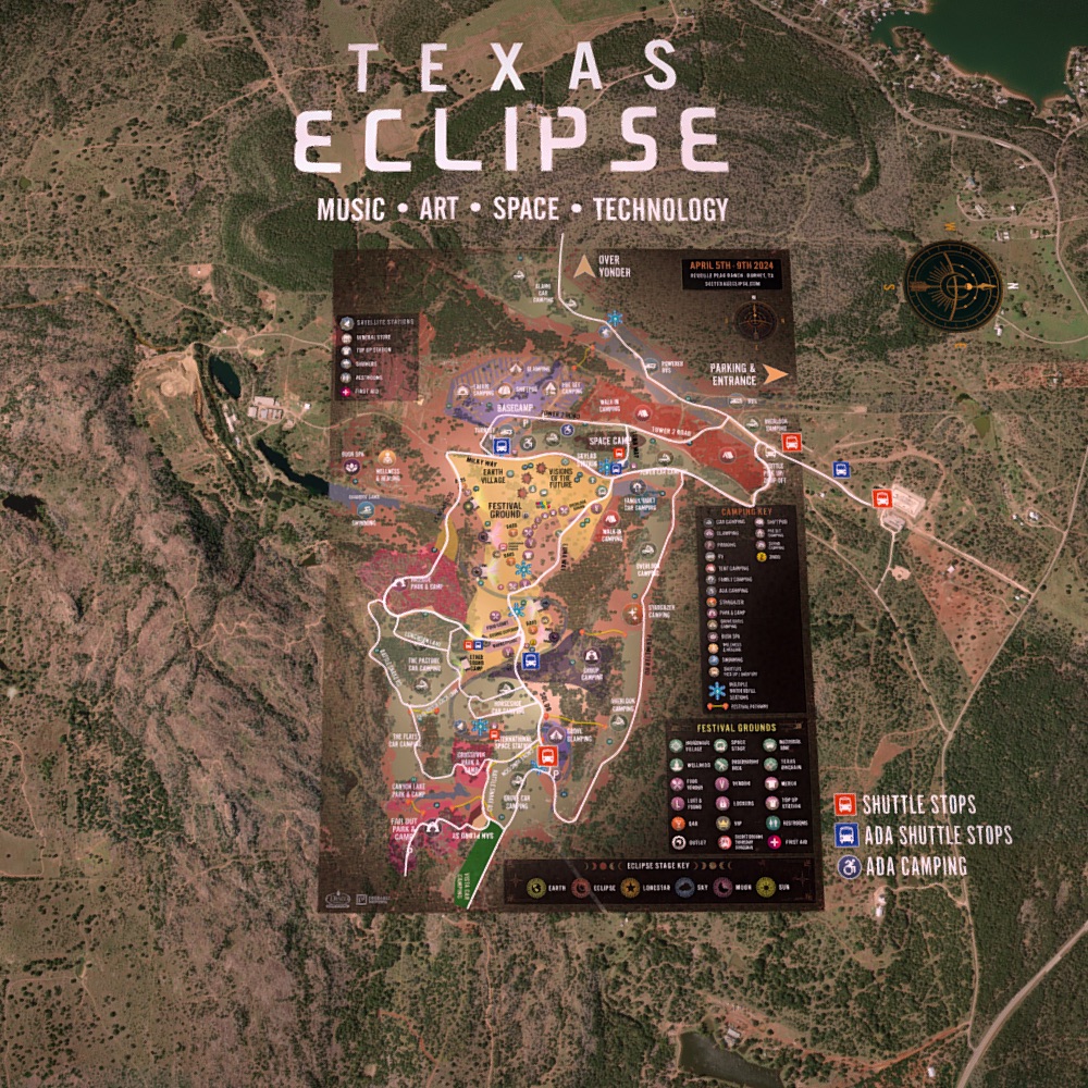
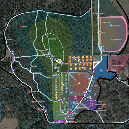
Land & Events Mapping Package
Geo-spatial design, 2D-3D maps, asset digitization, content development, and data services.
Land Projects | Events | Venues
Data & Content Development
Design: 3D maps / Logos / QR Codes
Print Ready and Web Embeddable

Beautifully Labeled 3D Maps
Create and capture stunning 3D location maps and city visualizations, available for nearly any location world-wide.
Create Custom Data Sets and Labels
Easily Capture Location Snapshots
Simple and Intuitive Interface
White-label Implementations Available
Location Discovery with Deep Research
Experience Design & Development
Content for 3D web integration, apps, and platform development for creative business.
Application and Platform Development
World Building for 3D Applications
Media and Content Development
100% White-label Platform Ownership
Cross Domain Expertise